Falcon 9 Block 5 | SWOT (Surface Water and Ocean Topography)
Launch Successful
L - -- : -- : -- : --
Launch Window
Dec. 16, 2022, 11:46 a.m. - Dec. 16, 2022, 11:56 a.m.
Dec. 16, 2022, 11:46 a.m. - Dec. 16, 2022, 11:56 a.m.
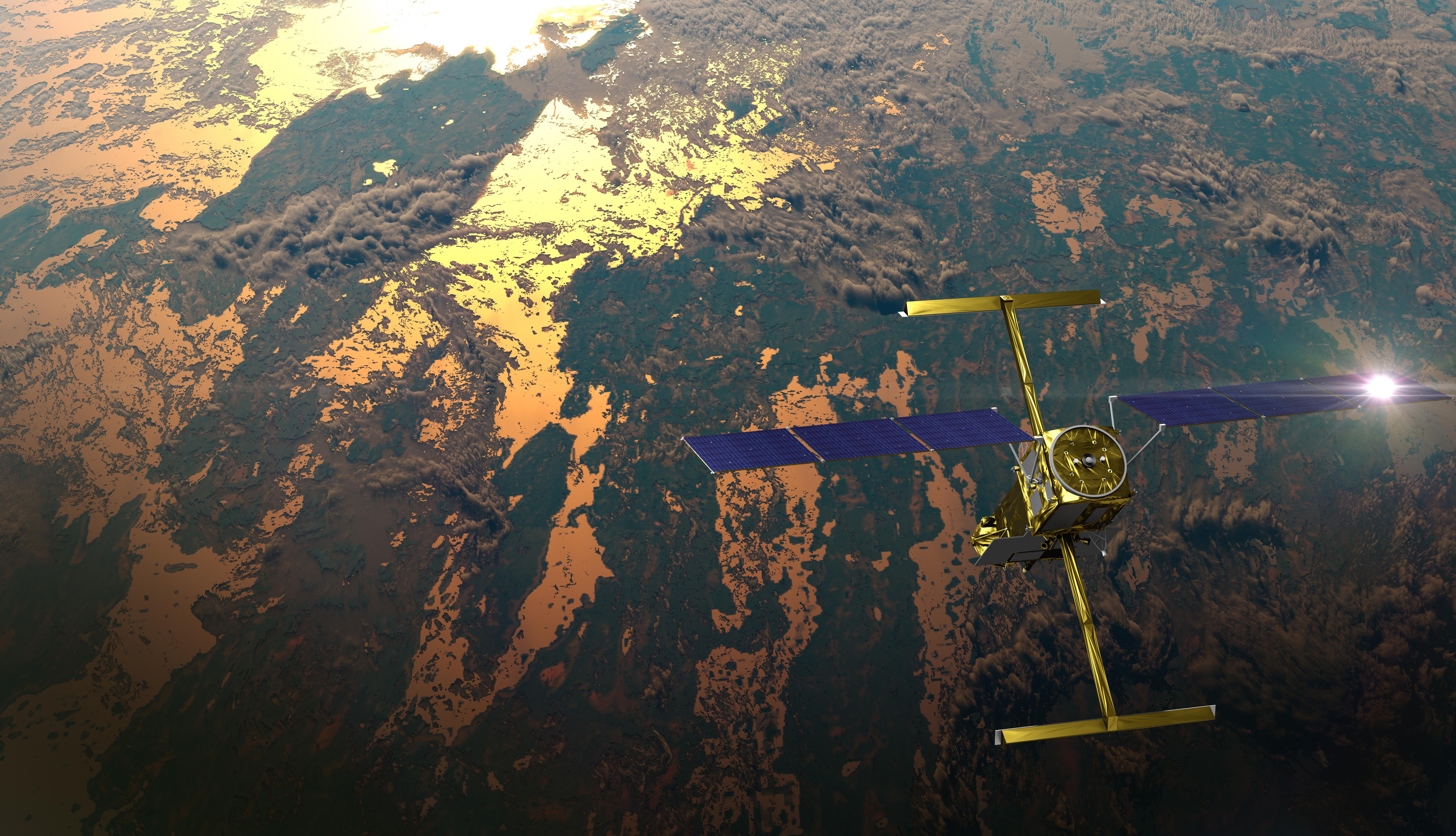
Satellite altimeter jointly developed by NASA and CNES, the French space agency, in partnership with the Canadian Space Agency (CSA) and UK Space Agency (UKSA) designed to make the first global survey of the Earth's surface water, to observe the fine details of the ocean surface topography, and to measure how terrestrial surface water bodies change over time.
Launch trajectory and telemetry simulations provided by Flight Club - a rocket launch simulator and orbital trajectory visualiser for all things space!

Good deployment and AOS confirmed, successful launch
Liftoff
Coverage live

NET December 16

Weather 100%
Falcon 9 is a two-stage rocket designed and manufactured by SpaceX for the reliable and safe transport of satellites and the Dragon spacecraft into orbit. The Block 5 variant is the fifth major interval aimed at improving upon the ability for rapid reusability.
See DetailsThe Falcon 9 booster has successfully landed back at the launch site after this flight.
Result: Successful Return to Launch Site landing at Landing Zone 4.Space Exploration Technologies Corp., known as SpaceX, is an American aerospace manufacturer and space transport services company headquartered in Hawthorne, California. It was founded in 2002 by entrepreneur Elon Musk with the goal of reducing space transportation costs and enabling the colonization of Mars. SpaceX operates from many pads, on the East Coast of the US they operate from SLC-40 at Cape Canaveral Space Force Station and historic LC-39A at Kennedy Space Center. They also operate from SLC-4E at Vandenberg Space Force Base, California, usually for polar launches. Another launch site is being developed at Boca Chica, Texas.
INFO WIKI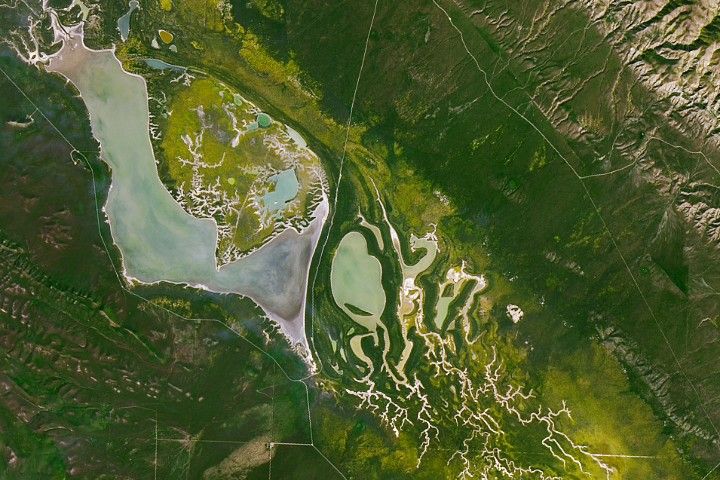
Explore how rivers move, change, and sustain life across the planet with SWOT data.
Rivers rise and fall throughout the year, but by how much? Perhaps less than previously thought, according to new data from the SWOT mission. Hidden riverbed contours are also emerging. In a first, a space mission led by NASA and France ha…

Blacksburg VA (SPX) Jan 21, 2026 What's the shape of water? In 2022, NASA launched the Surface Water and Ocean Topography (SWOT) satellite to answer this question by precisely measuring the height and extent of bodies of water. Vi…
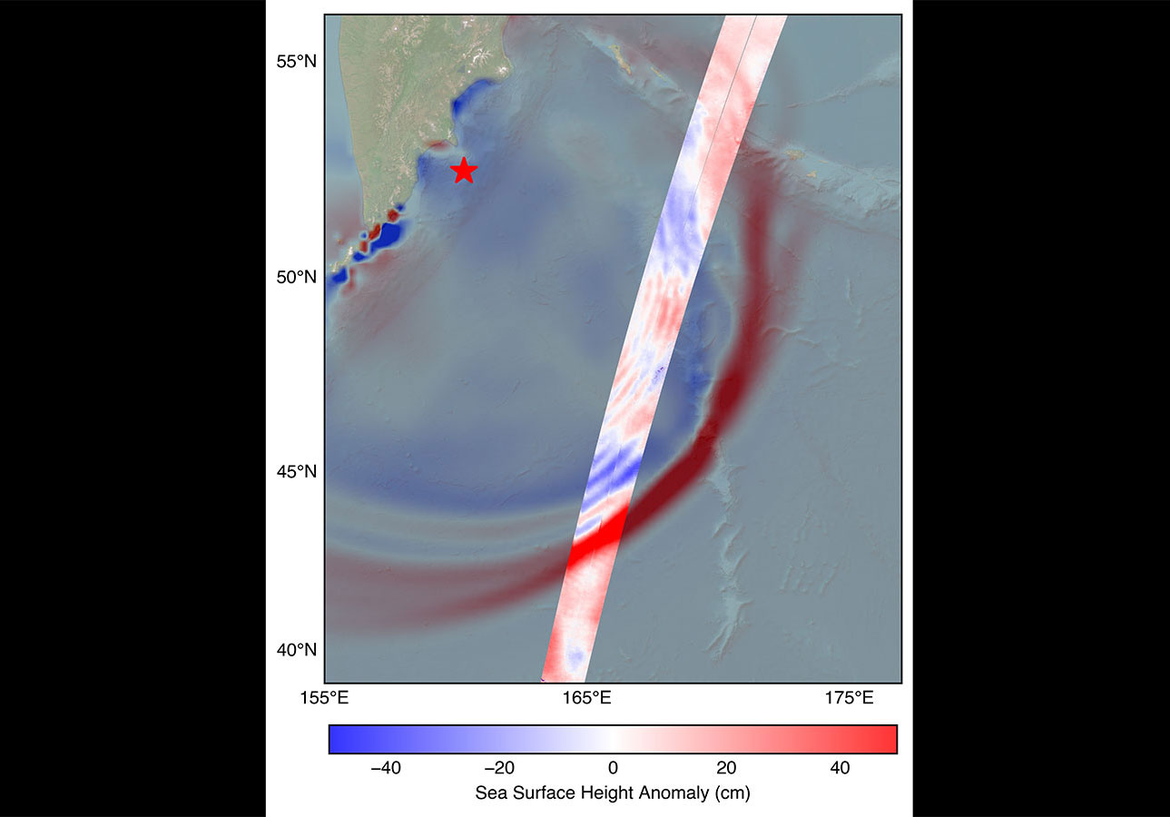
Data provided by the water satellite, a joint effort between NASA and the French space agency, is helping to improve tsunami forecast models, benefitting coastal communities. The SWOT (Surface Water and Ocean Topography) satellite captured…

In a first, researchers from NASA and Virginia Tech used satellite data to measure the height and speed of potentially hazardous flood waves traveling down U.S. rivers. The three waves they tracked were likely caused by extreme rainfall an…
This is the 24th flight of the Orbital ATK's uncrewed resupply spacecraft Cygnus and its 23rd flight to the International Space Station under the Com…
Officially described as "Satellite-Internet Technology Demonstration Satellite". Probable 1 (?) test satellite for the Chinese state-owned LEO commun…
A batch of 25 satellites for the Starlink mega-constellation - SpaceX's project for space-based Internet communication system.
A batch of 5 Low Earth Orbit communication satellites for the Chinese state owned SatNet constellation operated by the China Satellite Network Group.…
18 Low Earth Orbit communication satellites with Ku, Q and V band payloads for the G60 constellation operated by Shanghai Spacesail Technologies with…
STP-S29A is a mission under the U.S. Department of Defense's Space Test Program (STP) that will deliver technology demonstrations to orbit and contri…
A batch of 25 satellites for the Starlink mega-constellation - SpaceX's project for space-based Internet communication system.
Amazon Leo, formerly known as Project Kuiper, is a mega constellation of satellites in Low Earth Orbit that will offer broadband internet access, thi…
Note: Payload identity uncertain. Meridian is a series of communications satellite for military and civilian use.
First test launch of Space Pioneer’s Tianlong-3 rocket.