Upcoming Spaceflight Launches
Filter by Agency, Locations or Vehicles
Show All Launches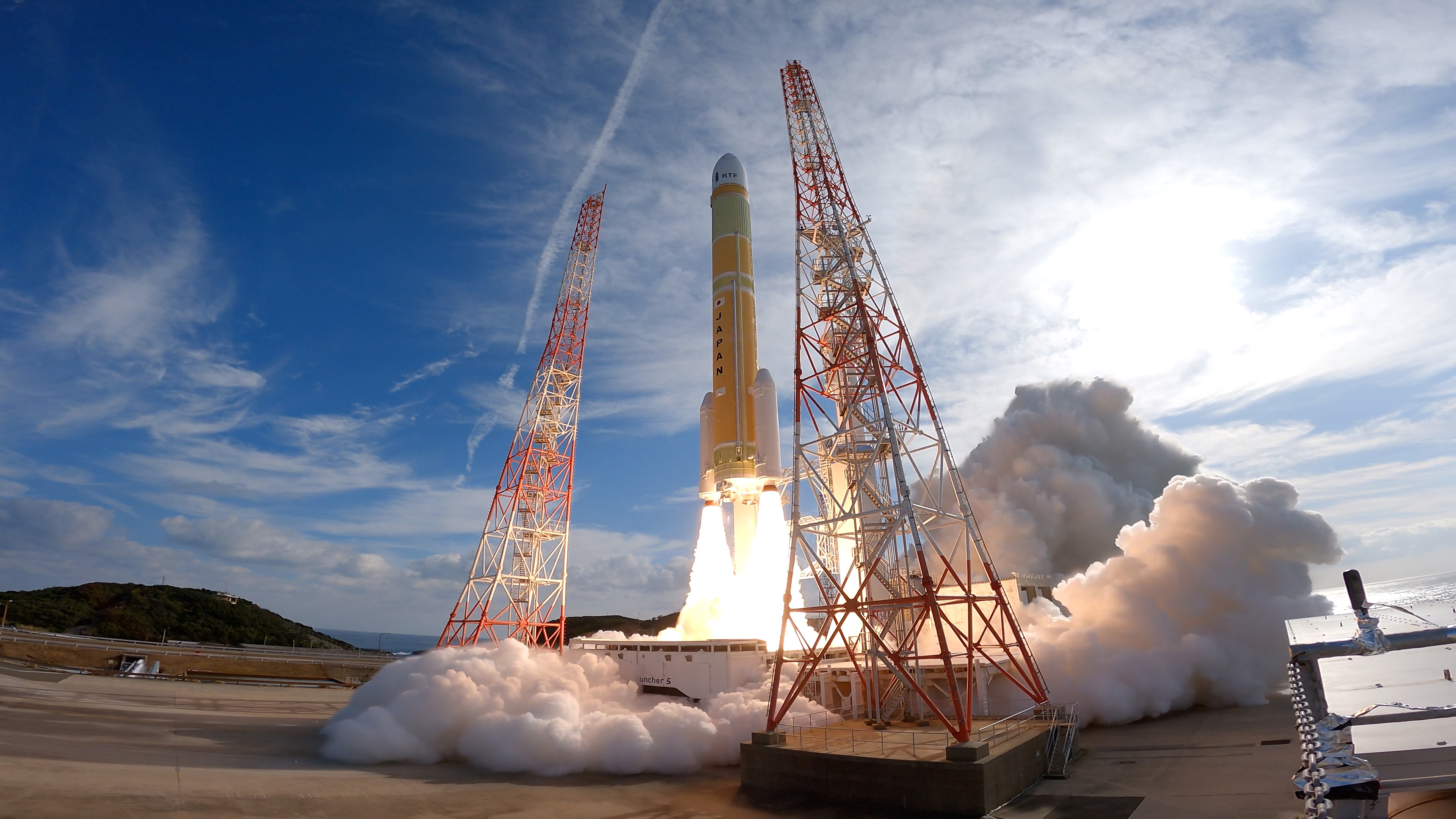
H3-22 | Michibiki 7 (QZS-7)
Mitsubishi Heavy Industries | JapanTanegashima Space Center, Japan
TBD December, 2026
Status: To Be Determined
Mission:
QZSS (Quasi Zenith Satellite System) is a Japanese satellite navigation system operating from inclined, elliptical geosynchronous orbits to achieve optimal high-elevation visibility in urban canyons and mountainous areas. The navigation system objective is to broadcast GPS-interoperable and augmentation signals as well as original Japanese (QZSS) signals from a three-spacecraft constellation. The navigation system objective is to broadcast GPS-interoperable and augmentation signals as well as original Japanese (QZSS) signals from a three-spacecraft constellation in inclined, elliptical geosynchronous orbits.
Geostationary Transfer Orbit
Pallas-1 | Demo Flight
Galactic Energy | ChinaJiuquan Satellite Launch Center, People's Republic of China
TBD December, 2026
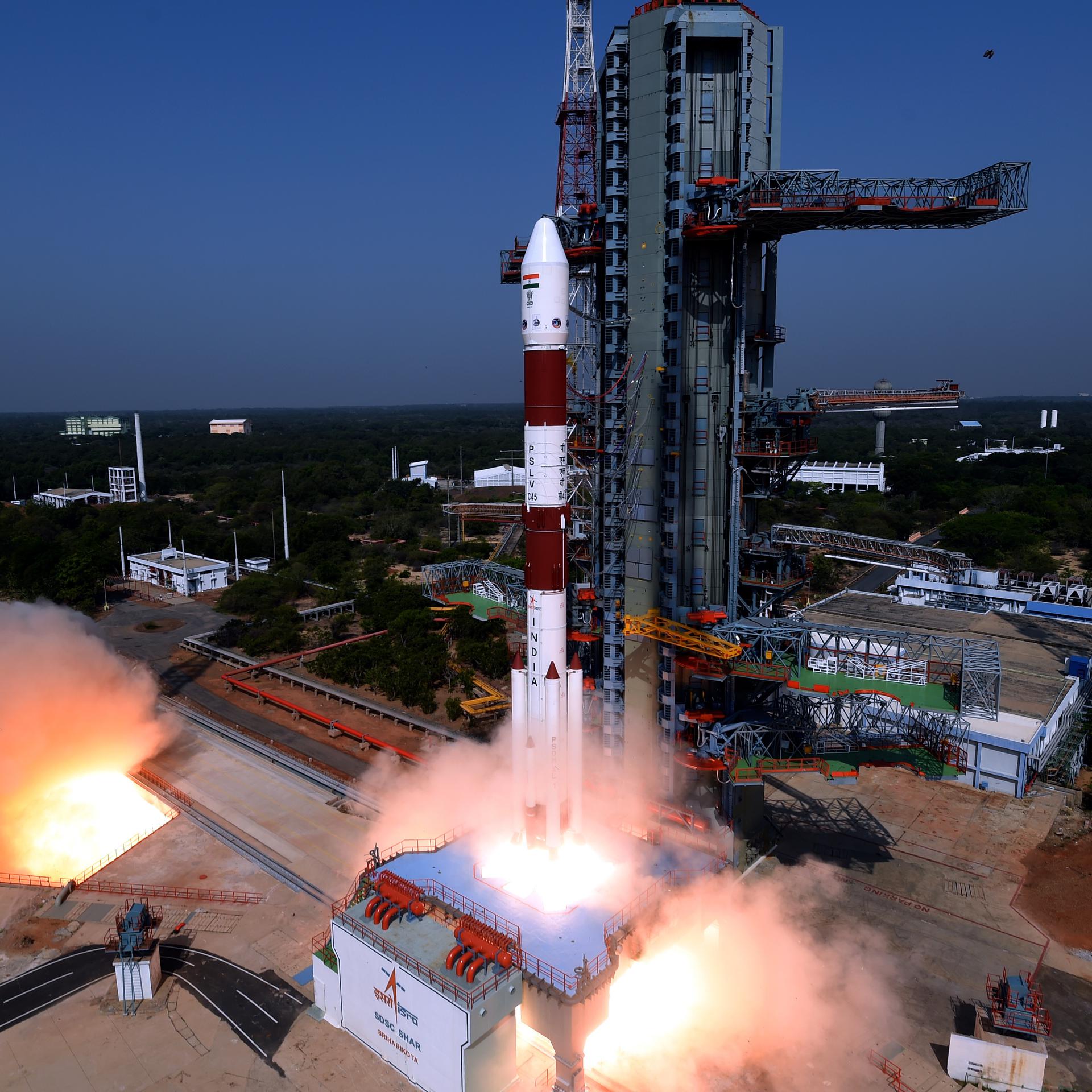
PSLV | TDS-01
Indian Space Research Organization | IndiaSatish Dhawan Space Centre, India
TBD December, 2026
Status: To Be Determined
Mission:
TDS-01 (Technology Demonstration Satellite-01) is an Indian geostationary orbit technology demonstration satellite carrying payloads for the Indian Space Research Organisation (ISRO)’s Institute of Plasma Research, Gandhinagar and the CSIR-CEERI, Pilani. Payloads to be tested included an internally developed 300 mN electric powered thrusters, atomic clocks, travelling wave tube amplifiers (TWTA) & a quantum communication suite (QuTDS).
Geostationary Transfer OrbitPSLV | RISAT-2A
Indian Space Research Organization | IndiaSatish Dhawan Space Centre, India
TBD December, 2026

Electron | StriX Launch 13
Rocket Lab | United States of AmericaRocket Lab Launch Complex 1, Mahia Peninsula, New Zealand
TBD December, 2026
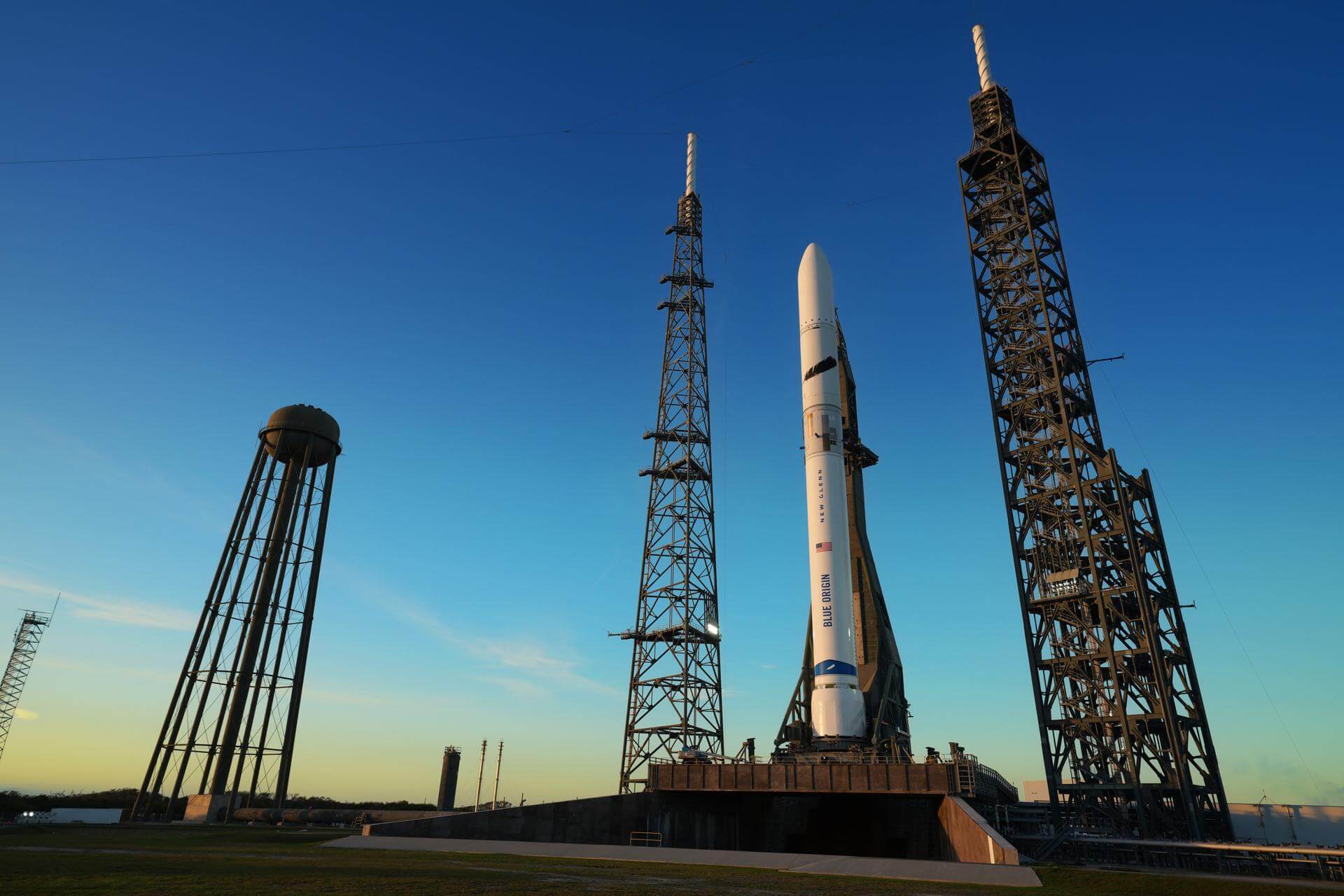
New Glenn | BlueBird Block 2 #4
Blue Origin | United States of AmericaCape Canaveral SFS, FL, USA
TBD December, 2026
Status: To Be Determined
Mission:
AST SpaceMobile’s Block 2 BlueBird satellites are designed to deliver up to 10 times the bandwidth capacity of the BlueBird Block 1 satellites, required to achieve 24/7 continuous cellular broadband service coverage in the United States, with beams designed to support a capacity of up to 40 MHz, enabling peak data transmission speeds up to 120 Mbps, supporting voice, full data and video applications. The Block 2 BlueBirds, featuring as large as 2400 square foot communications arrays, will be the largest satellites ever commercially deployed in Low Earth orbit once launched. This launch will feature 8 satellites.
Low Earth Orbit
Falcon 9 Block 5 | Telesat Lightspeed 5
SpaceX | United States of AmericaCape Canaveral SFS, FL, USA
TBD December, 2026
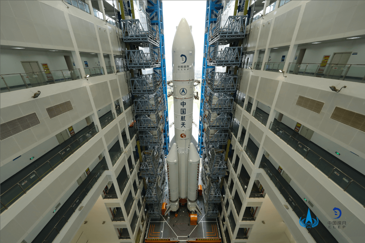
Long March 5 | Chang'e 7
China Aerospace Science and Technology Corporation | ChinaWenchang Space Launch Site, People's Republic of China
TBD December, 2026
Status: To Be Determined
Mission:
Chang'e 7/CE-7 is scheduled to launch in 2026, including an orbiter, a lander, a mini-hopping probe, and a rover. The mission will land in the South Pole regions of the Moon to study lunar surface environment around the South Pole, especially in looking for water ice in lunar soil.
Lunar OrbitFalcon 9 Block 5 | Rivada 1
SpaceX | United States of AmericaVandenberg SFB, CA, USA
TBD December, 2026
Electron | 6x HawkEye 360
Rocket Lab | United States of AmericaWallops Flight Facility, Virginia, USA
TBD December, 2026
Status: To Be Determined
Mission:
HawkEye 360 is a a space-based civil global intelligence satellite network using radio frequency (RF) technology to help monitor transportation across air, land and sea and assist with emergencies, and to provide civil SIGINT (Signal Intelligence) mission. The constellation of small satellites (named Hawk ) will collect information on specific radio signals worldwide to provide high-precision radio frequency mapping and analytics from Low Earth orbit (LEO).
Low Earth OrbitFalcon 9
Starlink Group 17-35
Space Launch Complex 4E - Vandenberg SFB, CA, USAA batch of 25 satellites for the Starlink mega-constellation - SpaceX's project for space-based Internet communication system.
Atlas V 551
Amazon Leo (LA-05)
Space Launch Complex 41 - Cape Canaveral SFS, FL, USAAmazon Leo, formerly known as Project Kuiper, is a mega constellation of satellites in Low Earth Orbit that will offer broadband internet access, thi…
Soyuz 2.1a/Fregat-M
Meridian-M No.21L
43/3 (43L) - Plesetsk Cosmodrome, Russian FederationNote: Payload identity uncertain. Meridian is a series of communications satellite for military and civilian use.
Tianlong-3
Demo Flight
Tianlong-3 Launch Pad - Jiuquan Satellite Launch Center, People's Republic of ChinaFirst test launch of Space Pioneer’s Tianlong-3 rocket.
Falcon 9
Starlink Group 10-58
Space Launch Complex 40 - Cape Canaveral SFS, FL, USAA batch of 29 satellites for the Starlink mega-constellation - SpaceX's project for space-based Internet communication system.
Space Launch System (SLS)
Artemis II
Launch Complex 39B - Kennedy Space Center, FL, USAArtemis II is the first crewed mission as part of the Artemis program. Artemis II will send a crew of 4 - 3 Americans and 1 Canadian around the moon …
Falcon 9
Starlink Group 10-44
Space Launch Complex 40 - Cape Canaveral SFS, FL, USAA batch of 29 satellites for the Starlink mega-constellation - SpaceX's project for space-based Internet communication system.
Falcon 9
Transporter 16 (Dedicated SSO Rideshare)
Space Launch Complex 4E - Vandenberg SFB, CA, USADedicated rideshare flight to a sun-synchronous orbit with dozens of small microsatellites and nanosatellites for commercial and government customers.
Kinetica 2
Demo Flight (Qingzhou Prototype Spacecraft)
Launch Area 140 - Jiuquan Satellite Launch Center, People's Republic of ChinaFirst test launch and mission of CAS Space’s Kinetica-2 rocket, with 3 spacecraft on board: * New March 02 (Qingzhou space station cargo resupply …
Electron
Daughter Of The Stars (LEO-PNT Pathfinder A)
Rocket Lab Launch Complex 1A - Rocket Lab Launch Complex 1, Mahia Peninsula, New ZealandThe European Space Agency (ESA)'s LEO-PNT (Low Earth Orbit Positioning, Navigation and Timing) demonstrator mission will feature a 10-satellite const…

